|
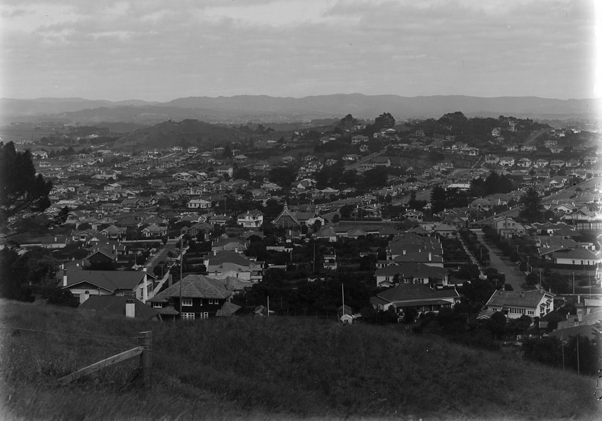
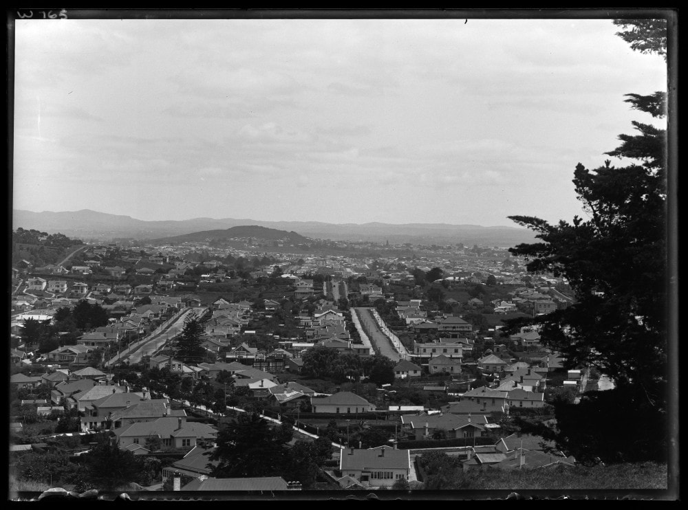
Greenwoods Corner is an Auckland neighbourhood located between Epsom and Royal Oak, at the intersection of Pah Road and Manukau Road. It is settled in the lee of Maungakiekie / One Tree Hill and serves as a convenient launching point for the area's many attractions. Cornwall Park with Maungakiekie and the Stardome Observatory, Alexandra Park with its harness-racing track, and Monte Cecilia Park with the Pah Homestead and TSB Bank Wallace Arts Centre are all a convenient distance from Greenwoods Corner (within 2.5 km).
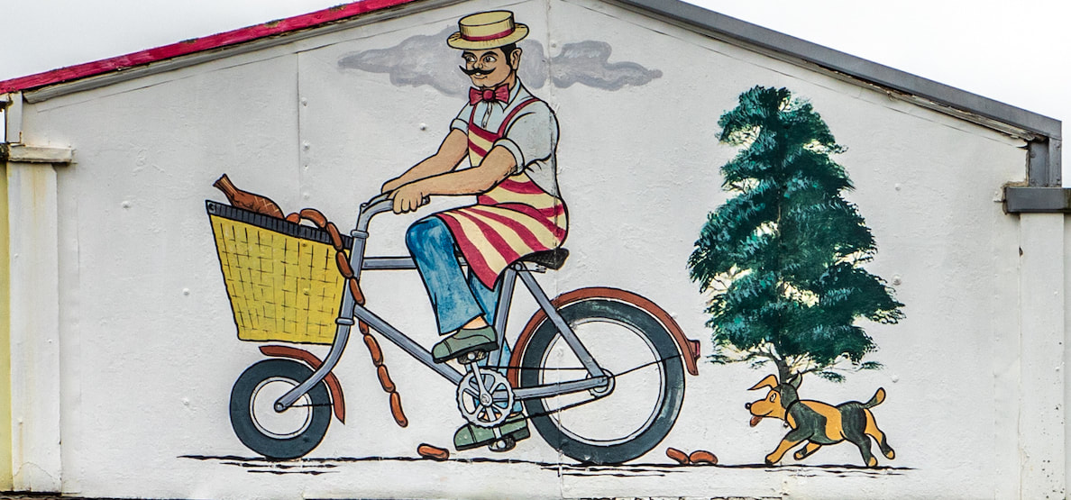
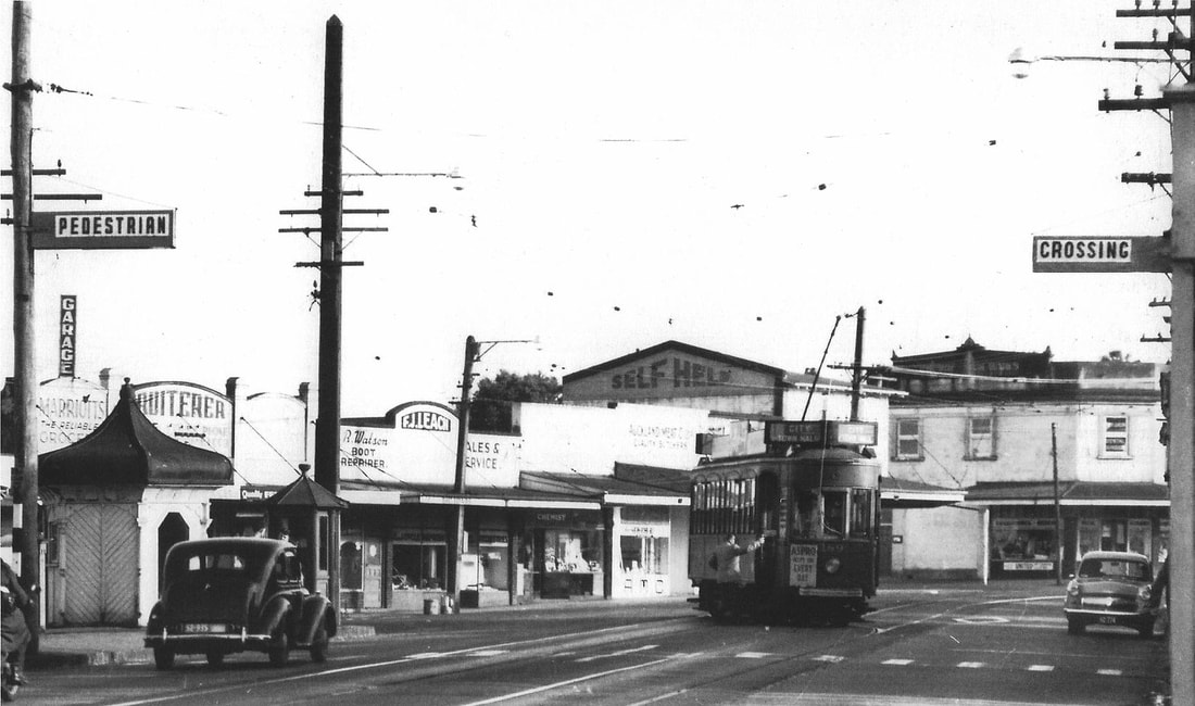
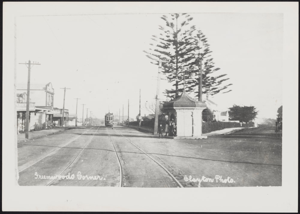
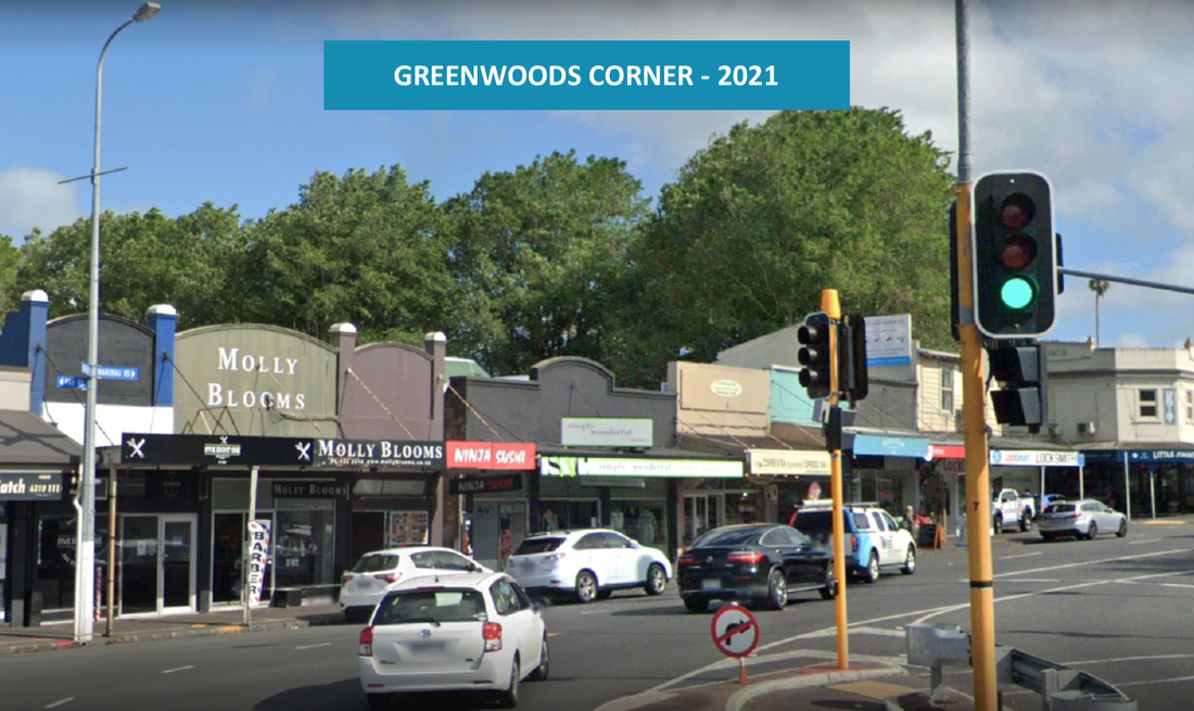
Greenwoods Corner shopping village is made up of a collection of small enterprises: restaurants, cafés, and retail businesses. It is located only 7.3km from the Auckland Central Business District (CBD). Greenwoods Corner was named after an early English landowner, Mr William Greenwood, who purchased the six acres that became Greenwoods Corner for 43 pounds, 5 shillings, and 8 pence in 1842. Greenwood built a homestead on a triangular section and sold the remaining land to a syndicate for a subdivision in 1909. The Greenwood family kept the homestead for 110 years, a significant period of time considering Auckland's short history as a city. During its early development Greenwoods Corner was defined by Manukau Road on the east, Pah Road on the west, and Mount Albert Road at its base (south). Southern Epsom was rural at the time of the first homestead of Greenwoods Corner and was characterized by green fields and grazing cattle. Originally two Norfolk pines framed the Greenwood Homestead at the triangle in the road, as defining features of the community. Both the pines and the homestead were pulled down by the city for a road widening and improvement scheme in 1954 and the Auckland Savings Bank now stands in the homestead's place. GREENWOODS CORNER EPSOM HISTORICAL WALK This self-guided walk features fourteen key historical sites in and around Greenwoods Corner. Historical narratives, photographs, advertisements and audio clips have been uploaded for individual stop locations onto a purpose-built, free to use mobile App. Stainless steel plaques for many of the stops have been installed along the route, which is centred on Manukau Road, between the Epsom Methodist Church to the south and the former Tram Barns to the north. The history of each stop on the walk is accessible either by scanning the QR code on the plaque at each location, by scrolling through each stop on the App or simply by clicking on the pins dropped along the App’s mapped route. Click here for a link to the Greenwoods Corner Epsom Historical Walk. |
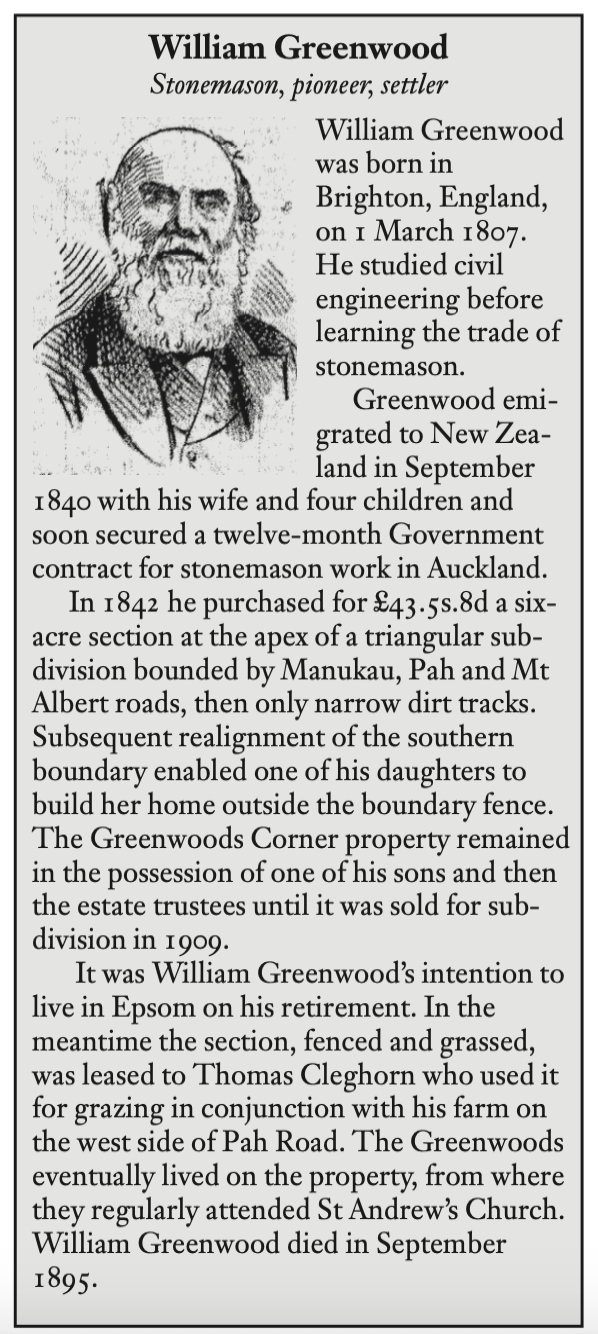
The above is a brief story of William Greenwood after whom Greenwoods Corner is named. It was written by Valerie Sherwood for 'The History of Epsom' edited by Dr Graham Bush and published by the Epsom & Eden District Historical Society in 2006; Thank you to Valerie Sherwood (a longstanding Epsom resident), for giving us permission to republish this information. |


|
|